SOBEK® “Your Premier Partner in Geospatial Intelligence.”
SOBEK® is a leader in comprehensive geospatial and surveying services, addressing the full spectrum of mapping, analysis, and environmental study needs. Our expertise spans GIS solutions, Mobile Mapping, Aerial Photography, Drone surveying, VRS station deployment, Land surveying, Satellite imagery procurement, training, consultancy, and integrated solution development.
Our diverse clientele includes governments, multinational corporations, environmental agencies, and urban planners who rely on our precision, innovation, and consultative approach to overcome challenges and seize opportunities. We pride ourselves on providing not just data, but smart, actionable insights that drive decisions and shape futures.
Our dedicated team of experts, state-of-the-art technology, and commitment to sustainability put us at the forefront of our industry. Through our services, we don’t just map the terrain; we map out paths for growth, development, and sustainable success. Be a partner with SOBEK® to harness the transformative power of geospatial intelligence for your projects and strategic goals.
Our Services
Discover a range of comprehensive and customizable GIS Products at Sobek, designed to suit your unique needs and aspirations
GIS-Mapping
“Geospatial Solutions, Through Maps”
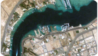
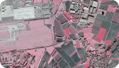
Satellite Imagery
“Capture the World: From the Space”
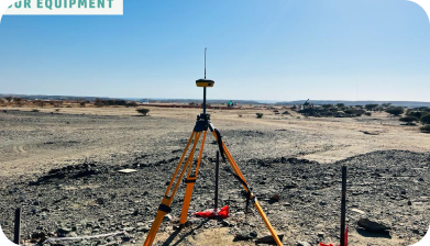
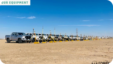
Land Survey
“Defining Boundaries with Precision”
Drone Agriculture
“Revolutionizing Farming from the Sky”
Drone Technology
“Mapping the Future with Aerial Intelligence”
Ground Penetrating Radar
“Penetrating Layers, Below Ground”
Mobile Mapping System
Accordion content goes here!
Why SOBEK®?
Global Impact
Extending our reach, expanding our global footprint, building strategic partnerships by providing global access to our advanced geospatial solutions and expertise.
Innovative Integration
Develop and offer integrated solutions that combine various data sources to reduce complexity, enhance data accuracy and service delivery with the highest safety standards in all operations.
Education & Training
We offer comprehensive training programs to develop expertise in GIS, system integration, drone operation, provide pilot licensing and geospatial analysis.
Client Success
To empower our clients with the highest level of accuracy and reliability in all our data collection, analysis services and integrated solutions that drive efficiency, growth, and success in their respective fields, Also Established a client advisory board to gather feedback and Exceed our customer expectations.
Innovation Leadership
Continuously advance our technology, stay at the forefront of technological advancements in mobile mapping, Land surveying, GIS, system integration, drone technology and Aerial Photography, maintaining our status as industry pioneers.
Sustainability Focus
Integrate sustainability principles into all services, by Implementing eco-friendly drone technologies and sustainable surveying practices to reduce environmental impact and to aid in conservation efforts and promote sustainable development practices across industries and communities we serve.
Community Engagement
Work with local communities to implement geospatial solutions that support sustainable development and resource management.
Research & Development
To invest in research that advances the field of geospatial sciences and contributes to the global body of knowledge, as we commit to incorporating environmental studies in project planning for sustainable development.
SOBEK® - Years Planned Ahead
Core Message
Mapping the Future, Connecting the World, SOBEK® is where technology meets territory. Our cutting-edge geospatial services and surveys bring data to life, transforming coordinates into actionable insights and strategic visions into reality.
Vision Statement
SOBEK® commits to deliver a comprehensive smart solutions in the geospatial and surveying sector, providing industry-leading GIS, geospatial analysis, land surveying, and mobile mapping, enriched with high-resolution satellite imagery, drone technology and cutting-edge Aerial Photography. We are dedicated to delivering precise, scalable, integrated geospatial solutions, enabling to capture, analyze, and utilize data with unparalleled precision and efficiency for a better-managed planet.
Mission Statement
SOBEK® aims to navigate the future through precision and innovation, transforming the global landscape by being the compass for geospatial intelligence, environmental foresight and sustainable development.
Core Message
Mapping the Future, Connecting the World, SOBEK® is where technology meets territory. Our cutting-edge geospatial services and surveys bring data to life, transforming coordinates into actionable insights and strategic visions into reality.
Vision Statement
SOBEK® commits to deliver a comprehensive smart solutions in the geospatial and surveying sector, providing industry-leading GIS, geospatial analysis, land surveying, and mobile mapping, enriched with high-resolution satellite imagery, drone technology and cutting-edge Aerial Photography.
Mission Statement
SOBEK® aims to navigate the future through precision and innovation, transforming the global landscape by being the compass for geospatial intelligence, environmental foresight and sustainable development.
SOBEK® - Live Projects
- All
- GIS-Mapping
- Land Survey
- Satellite Image
Our Digital Platforms
Start your Geospatial Journey with SOBEK®
Ready to take control of your maps? Let us help you achieve your goals with our tailored solutions and exceptional customer service

