
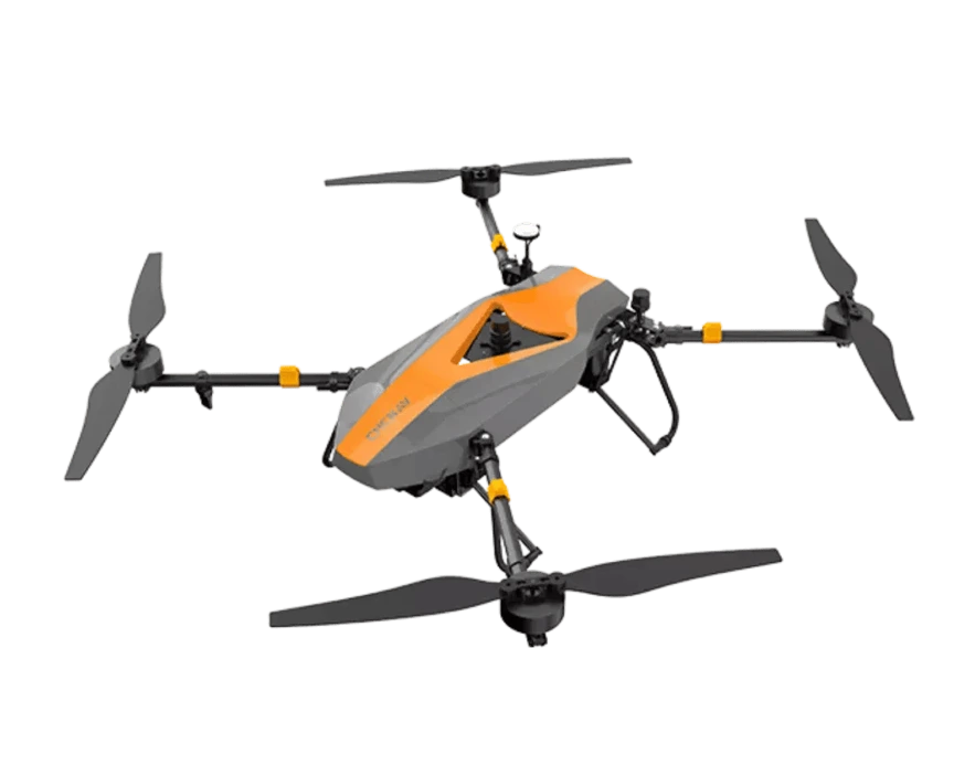
CHCNAV BB4
Product Description
The CHCNAV BB4 drone is a professional-grade UAV (Unmanned Aerial Vehicle) designed for high-precision aerial surveying, mapping, and other geospatial data collection tasks. Equipped with advanced GNSS technology and support for multiple payloads, the BB4 is tailored for industries that require accurate, efficient, and large-scale data collection, such as construction, land surveying, mining, and agriculture.
Technical Specifications
1. Key Specifications:
- Drone Type: Quadcopter UAV.
- Max Flight Time: Up to 90 minutes (depending on payload and environmental conditions).
- Max Range: Up to 15 km (communication/control range).
- Weight: Around 7-8 kg (without payload).
- Dimensions: 1020 x 1020 x 400 mm (with propellers deployed).
- Payload Capacity: Supports a range of payloads including RGB cameras, multispectral sensors, and LIDAR.
- Battery: High-capacity lithium-polymer batteries that provide long flight endurance.
- Wind Resistance: Up to 36 km/h (10 m/s or 22 mph).
- Operating Temperature: -20°C to 50°C (-4°F to 122°F).
- GNSS Technology: Integrated RTK/PPK (Real-Time Kinematic/Post-Processed Kinematic) for centimeter-level accuracy.
2. Payload and Sensor Options:
The BB4 drone is highly adaptable, allowing the integration of different types of sensors depending on the project requirements:
- RGB Cameras: High-resolution cameras, such as the Sony A7R or Phase One, for generating detailed Orth mosaics and 3D models.
- Multispectral Sensors: Suitable for agricultural applications (e.g., MicaSense RedEdge-MX), allowing plant health monitoring, vegetation analysis, and NDVI calculations.
- LIDAR: For precise terrain mapping and generating point clouds, LIDAR sensors can penetrate through vegetation and provide highly accurate 3D data.
3. Flight Performance:
- Flight Endurance: With its maximum flight time of up to 90 minutes, the BB4 is ideal for covering large areas in a single flight, making it particularly useful for large-scale mapping and surveying operations.
- Autonomous Flight Modes: The BB4 can conduct fully autonomous missions, including takeoff, flight path execution, and landing, through CHCNAV’s mission planning software, CoPilot.
- Terrain Following: The drone can follow terrain contours to maintain a consistent altitude during data collection, ensuring uniformity in data captured across different elevations.
4. RTK/PPK GNSS for High Precision:
- RTK (Real-Time Kinematic): The BB4 drone utilizes RTK technology to provide real-time corrections for GNSS data, ensuring centimeter-level accuracy during flight.
- PPK (Post-Processed Kinematic): In cases where real-time correction is not feasible, PPK is used for post-processing the flight data to achieve even higher precision.
- Accuracy: The BB4’s GNSS system ensures centimeter-level accuracy in mapping and surveying projects, reducing the need for extensive ground control points (GCPs).
5. Applications of the CHCNAV BB4 Drone:
- Land Surveying and Mapping: Ideal for generating Digital Elevation Models (DEMs), Digital Terrain Models (DTMs), and high-resolution Orth mosaics for land surveying tasks.
- Construction: The BB4 can assist in construction site mapping, progress tracking, and volume estimation, providing valuable 3D models and updates on project status.
- Mining: In mining operations, the BB4 can be used for high-accuracy stockpile volume calculations, terrain analysis, and tracking material quantities in an efficient and safe manner.
- Precision Agriculture: Equipped with multispectral sensors, the BB4 can provide insights into crop health, detect irrigation issues, and assess overall agricultural productivity.
- Environmental Monitoring: The BB4 is suitable for forestry management, wildlife habitat monitoring, coastal erosion studies, and environmental impact assessments.
6. Software and Data Processing:
CHCNAV drones, including the BB4, integrate seamlessly with industry-leading data processing software, ensuring that raw flight data can be easily converted into actionable insights.
- Mission Planning: CHCNAV’s CoPilot software allows users to design precise flight paths, define waypoints, and control flight parameters.
- Photogrammetry Software: The BB4 is compatible with popular photogrammetry software such as Pix4D, Agisoft Metashape, and DroneDeploy for processing aerial imagery into detailed maps, models, and ortho mosaics.
- LIDAR Processing: When using LIDAR sensors, the collected point cloud data can be processed using specialized software to generate high-resolution 3D models of terrain and infrastructure.
7. Durability and Environmental Resistance:
- Weather Resistance: The BB4 is designed to handle tough environmental conditions and can operate in light rain and dusty environments, with an IP rating that protects it from water and dust ingress.
- Wind Resistance: With the ability to withstand wind speeds of up to 36 km/h (10 m/s or 22 mph), the BB4 is a reliable option even in windy conditions.
8. Safety Features:
- Failsafe Systems: The BB4 comes with multiple failsafe features, including an automatic Return-to-Home (RTH) function in case of communication loss or low battery.
- Obstacle Avoidance: Advanced obstacle avoidance sensors help the drone navigate around objects and avoid collisions.
- Redundant GNSS Systems: Dual GNSS antennas ensure stable positioning even in challenging environments, reducing the risk of signal loss.
9. Battery System and Charging:
- Battery Life: The drone’s 90-minute flight time is powered by high-capacity lithium-polymer batteries, allowing it to cover large areas without frequent recharges.
- Swappable Batteries: For extended operations, the batteries are swappable, allowing quick turnarounds between missions.
- Intelligent Battery Management: The drone features an advanced battery management system to monitor power levels and optimize consumption during flight.