
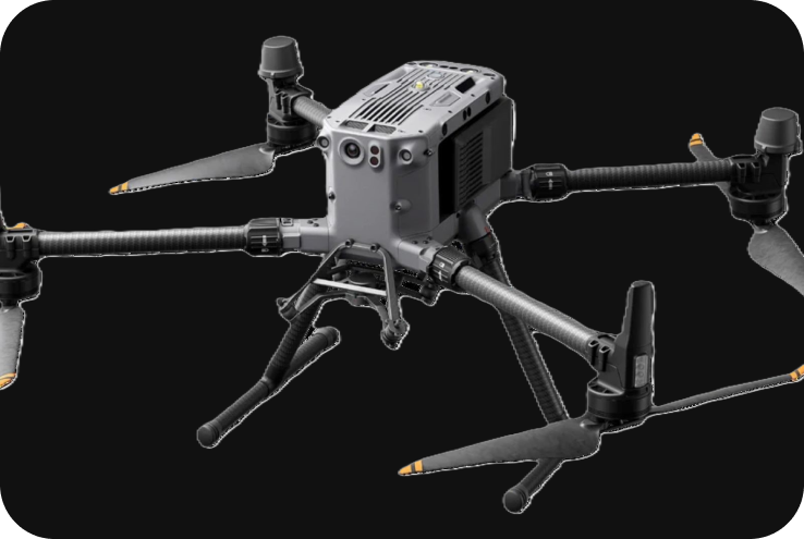
DJI Matrice 350 RTK
The DJI Matrice 350 RTK is an advanced, versatile, and rugged enterprise-grade drone designed for professional applications requiring high-precision geospatial data, inspection, and surveillance. It is an upgrade to DJI’s previous Matrice series and features significant improvements in performance, flight time, and payload capacity. The Matrice 350 RTK is well-suited for industries such as land surveying, construction, agriculture, mining, public safety, and infrastructure inspection.
Technical Specifications
1. Key Specifications:
- Drone Type: Quadcopter UAV.
- Max Flight Time: Up to 55 minutes (depending on payload and environmental conditions).
- Max Transmission Range: Up to 20 km using OcuSync 3 Enterprise.
- Payload Capacity: Supports up to 2.7 kg of payload (including multiple cameras and sensors).
- GNSS Technology: Built-in RTK (Real-Time Kinematic) system for centimeter-level positioning accuracy.
- Battery: Powered by two TB65 Intelligent Flight Batteries with self-heating technology.
- Ingress Protection (IP) Rating: IP55, making it water and dust-resistant.
- Operating Temperature: -20°C to 50°C (-4°F to 122°F).
- Wind Resistance: Can resist wind speeds up to 54 km/h (15 m/s).
2. Flight Performance:
- Max Flight Time: The Matrice 350 RTK offers a maximum flight time of up to 55 minutes, allowing it to cover large areas in a single mission, which is crucial for extended mapping, surveying, and inspection tasks.
- Max Speed: It can reach speeds of 23 m/s (approx. 83 km/h), enabling quick transit between survey points or inspection sites.
- Transmission Range: With OcuSync 3 Enterprise, the drone offers a control and video transmission range of up to 20 km, ensuring stable communication even in challenging environments.
- Altitude Range: Maximum service ceiling altitude is 7000 m (23,000 feet) above sea level, suitable for high-altitude operations.
- Intelligent Dual Battery System: The dual TB65 batteries enable hot-swapping, ensuring minimal downtime between missions.
3. RTK System for High-Precision Accuracy:
The Matrice 350 RTK is equipped with an advanced RTK module that enables centimeter-level positioning accuracy, making it ideal for surveying and mapping applications that require precise geospatial data.
- RTK Corrections: It supports real-time GNSS corrections for accurate georeferencing of aerial images and point cloud data.
- PPK Support: In addition to real-time RTK corrections, Post-Processed Kinematic (PPK) is also supported, allowing users to process data post-fight for high accuracy when real-time corrections aren’t available.
- Compatibility with D-RTK 2 Mobile Station: The drone can pair with DJI’s D-RTK 2 Mobile Station for improved positioning accuracy, especially in areas with poor GNSS signal.
4. Payload and Camera Options:
One of the key advantages of the Matrice 350 RTK is its ability to carry multiple payloads. It supports a wide range of DJI Enterprise payloads, allowing the drone to be tailored for various applications. Some of the notable payloads include:
- Zenmuse H20 Series: It’s Multi-sensor payload with 20 MP zoom camera, 12 MP wide camera, 640 x 512 thermal camera, and laser rangefinder. Also, Zenmuse H20N Features night vision capabilities, including a thermal camera and low-light sensors, for night-time operations and low-light inspections.
- Zenmuse P1: It’s a full-frame, 45 MP camera designed for photogrammetry and surveying. With its high resolution and mechanical shutter, it is ideal for creating detailed maps, Orth mosaics, and 3D models.
- Zenmuse L1: It’s a LIDAR payload that provides high-accuracy point cloud data. It includes an integrated IMU, 1-inch CMOS camera, and livestreaming LIDAR for real-time 3D data collection.
5. Applications:
- Land Surveying & Mapping: Precision Photogrammetry: With the Zenmuse P1 or Zenmuse L1, the drone delivers precise digital elevation models (DEMs), Orth mosaics, and point clouds for surveying and geospatial data collection.
- Construction: The Matrice 350 RTK can be used to monitor construction sites, generate progress reports, and measure stockpile volumes with high precision using the Zenmuse P1 and L1 cameras. Real-time 3D Data: With the LIDAR sensor, construction managers can monitor terrain changes, volumes, and topographical data in real time.
- Public Safety and Search & Rescue: The Zenmuse H20T with thermal and zoom capabilities allows the Matrice 350 RTK to perform search and rescue operations, even in low visibility or at night. Thermal Imaging: Thermal sensors help detect human presence through heat signatures, making the drone invaluable for firefighting and disaster response.
- Infrastructure Inspection: With its high zoom capabilities, the drone can perform close-up inspections of critical infrastructure, such as power lines, bridges, wind turbines, and solar panels. Thermal Inspections: The Zenmuse H20T’s thermal camera detects heat anomalies in electrical infrastructure, identifying issues before they lead to failures.
- Agriculture: In precision agriculture, the Matrice 350 RTK can be used for crop monitoring, plant health analysis, and NDVI mapping with multispectral sensors.
6. Safety and Redundancy Features:
The Matrice 350 RTK comes equipped with several advanced safety systems that ensure reliability during flight operations:
- Six-Directional Sensing & Positioning: The drone is equipped with six-directional obstacle sensing and avoidance, ensuring safety during flight in complex environments.
- Multiple Redundant Systems: The drone has dual IMUs, dual barometers, and dual compasses, ensuring stability and reliability in case of sensor failure.
- Health Management System: The integrated system provides real-time monitoring of flight status, battery health, and critical components.
7. Ingress Protection & Durability:
- IP55 Rating: The Matrice 350 RTK is rated IP55, providing protection against dust and water, making it suitable for operations in harsh weather conditions, including light rain and dust.
- Durability: Built with enterprise-grade materials, the drone is designed to withstand tough environments, making it ideal for long-term industrial use.
8. Software Integration:
The Matrice 350 RTK is compatible with a variety of software tools for mission planning, data processing, and fleet management:
- DJI Pilot 2: The DJI Pilot 2 app provides seamless mission planning and control. It supports various mission types like waypoint, terrain-following, linear mapping, and inspection modes.
- DJI Terra: For post-processing and photogrammetry, DJI Terra transforms captured images into high-resolution maps, 3D models, and elevation data.
- Third-Party Software: The drone is compatible with third-party software like Pix4D, Drone Deploy, and other industry-standard mapping tools for specialized tasks.
9. Battery System:
- TB65 Intelligent Flight Battery: The Matrice 350 RTK uses two TB65 batteries, offering up to 55 minutes of flight time and hot-swappable capabilities, ensuring minimal downtime.
- Smart Battery Management: The DJI Battery Station optimizes the charging process and monitors battery health. The TB65 battery also supports self-heating for operations in cold environments.
- Hot-Swappable Batteries: Batteries can be swapped without powering off the drone, ensuring continuous operation.