
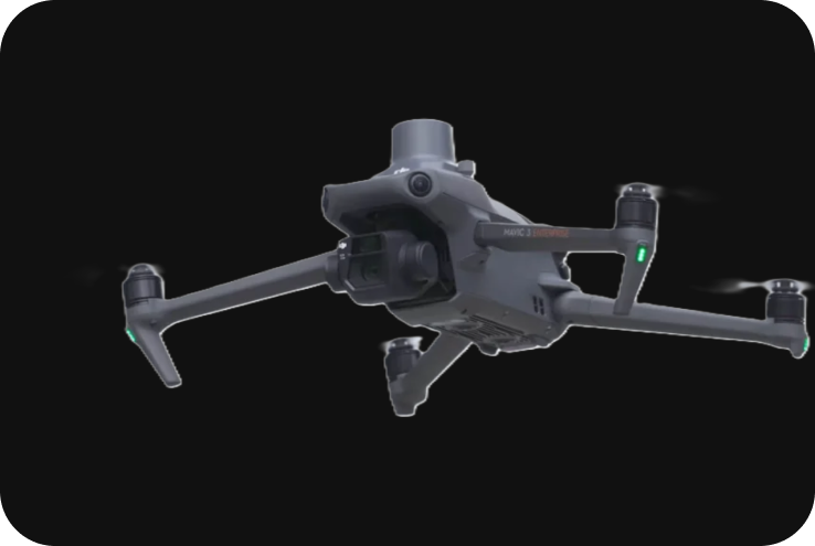
DJI Mavic 3 Enterprise
Product Description
The DJI Mavic 3 Enterprise series is a professional-grade drone designed for various enterprise applications such as surveying, mapping, public safety, and inspections. With high-end imaging capabilities, RTK support, and a compact foldable design, it offers a versatile solution for industries requiring detailed aerial data collection.
Technical Specifications
1. Key Specifications:
- Drone Type: Quad-copter.
- Max Flight Time: Up to 45 minutes.
- Max Speed: 21 m/s (47 mph).
- Max Take-Off Weight: 915 g (for the Mavic 3E) and 920 g (for the Mavic 3T).
- Max Payload: Integrated camera system (no external payload).
- Wind Resistance: 12 m/s (26.8 mph).
- Max Service Ceiling: 6,000 m (19,685 ft) above sea level.
- Operating Temperature: -10°C to 40°C (14°F to 104°F).
- Positioning System: GPS + GLONASS.
- RTK: Optional RTK module for centimeter-level accuracy (available with the Mavic 3E and Mavic 3T models).
- Obstacle Detection: Omnidirectional obstacle sensing with multiple vision sensors.
- Transmission System: DJI O3 Enterprise Transmission (up to 15 km transmission range).
2. Models and Variants:
The DJI Mavic 3 Enterprise series comes in two key variants, each catering to different professional needs:
- Mavic 3E (Enterprise): Designed for mapping and surveying with a high-resolution wide-angle camera and optional RTK module for high-precision georeferencing.
- Mavic 3T (Thermal): Equipped with both a thermal and visual camera, ideal for search and rescue, firefighting, and inspection operations requiring thermal imaging.
3. Camera Capabilities:
-
Mavic 3E (Enterprise): Wide-Angle Camera:
-
-
- Sensor: 4/3 CMOS sensor.
- Resolution: 20 MP.
- Lens: 24mm equivalent with mechanical shutter.
- Shutter Speed: 1/2000 – 2s.
- GSD (Ground Sampling Distance): 1 cm per pixel at 100 meters, making it ideal for mapping and 3D modeling.
- Digital Zoom: Up to 56x hybrid zoom (combination of optical and digital).
-
-
Mavic 3T (Thermal): Thermal Camera:
-
- Resolution: 640 x 512 px.
- Thermal Sensitivity: <50 mK.
- Temperature Measurement Range: -20°C to 150°C (-4°F to 302°F) and 150°C to 400°C (302°F to 752°F).
- Lens: 40mm equivalent.
- Wide-Angle Camera:
- Sensor: 1/2-inch CMOS sensor.
- Resolution: 48 MP for high-resolution RGB images.
- Zoom: 56x hybrid zoom.
4. RTK (Real-Time Kinematic) Module:
The DJI Mavic 3 Enterprise series supports optional RTK for centimeter-level positioning, which is crucial for tasks requiring high-precision data such as:
- Mapping & Surveying: Significantly reduces the need for Ground Control Points (GCPs).
- Centimeter-Level Accuracy: With the RTK module, the drone can achieve 1 cm horizontal and 1.5 cm vertical accuracy.
5. Flight Performance:
- Max Flight Time: Up to 45 minutes per battery, making it one of the longest-lasting enterprise drones in its class.
- Max Speed: 21 m/s (47 mph) in sport mode.
- Max Transmission Range: 15 km with DJI O3 Enterprise Transmission, ensuring stable video feed and control even in challenging environments.
- Omnidirectional Obstacle Avoidance: The Mavic 3 Enterprise series is equipped with multiple vision sensors on all sides, offering omnidirectional obstacle detection and avoidance, providing safe flight paths during autonomous missions.
6. Surveying and Mapping Features:
- Mechanical Shutter: The mechanical shutter on the Mavic 3E allows for accurate image capture without motion blur, making it ideal for surveying and mapping missions.
- Mapping Efficiency: The Mavic 3E can cover up to 2 square kilometers (200 hectares) in a single flight, making it highly efficient for large-area mapping projects.
- DJI Terra Integration: Fully compatible with DJI Terra, DJI’s mapping software, for mission planning, flight execution, and data processing into high-resolution orthophotos, 3D models, and point clouds.
7. Intelligent Features:
- Waypoints 2.0: Allows precise automated missions using pre-programmed flight routes, perfect for recurring inspections or large-area surveys.
- Mapping Mode: Optimized for grid and terrain following flight modes to collect consistent aerial imagery.
- AI Spot-Check: Uses artificial intelligence to detect and identify objects, which is useful for inspection and monitoring missions.
- Thermal Features (Mavic 3T): Provides real-time thermal data and supports features like temperature alarms, isotherms, and color palettes for detailed analysis.
8. DJI Cloud Integration:
- DJI Flight Hub 2: The Mavic 3 Enterprise integrates with DJI Flight Hub 2, offering real-time mission monitoring, data management, and collaboration tools for managing fleets and flight data in the cloud.
- Cloud-Based Control: Enables live streaming, mission scheduling, and fleet management from remote locations.
9. Applications:
The Mavic 3 Enterprise series is versatile and can be used across various industries:
- Land Surveying & Mapping: High-resolution imaging with RTK support for accurate terrain mapping and geospatial data collection.
- Public Safety: The Mavic 3T’s thermal camera is ideal for search and rescue missions, firefighting, and law enforcement activities, allowing operators to detect heat signatures in low-visibility conditions.
- Utilities and Infrastructure Inspection: Use the zoom capabilities and thermal imaging to inspect power lines, solar panels, wind turbines, and pipelines.
- Agriculture: Multispectral imaging (available in future integrations) can be used for precision farming, crop monitoring, and health assessments.
- Construction: Track progress, create topographic maps, and generate 3D models of construction sites to monitor site changes over time.
10. Safety and Redundancy Features:
- Advanced RTH (Return to Home): Automatically calculates the safest and most efficient route back to the home point, avoiding obstacles during the return flight.
- ADS-B Receiver: Alerts the drone operator to nearby manned aircraft to help avoid airspace conflicts.
- Obstacle Avoidance: Equipped with omnidirectional sensing using six fisheye sensors and two wide-angle sensors to detect and avoid obstacles in all directions.
11. Battery System and Charging:
- Intelligent Flight Battery: The Mavic 3 Enterprise uses Intelligent Flight Batteries (Li-ion) that can provide up to 45 minutes of flight time. This allows for extended missions without frequent battery changes.
- Charging Hub: The battery charging hub supports the charging of multiple batteries simultaneously, reducing downtime between flights.