
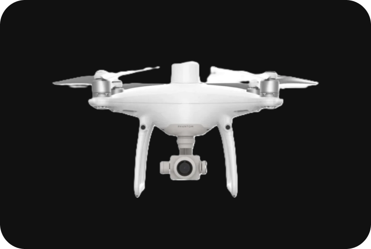
DJI Phantom 4 RTK
The DJI Phantom 4 RTK is a high-precision drone designed for aerial surveying and mapping. It’s part of DJI’s professional series, tailored for industries like land surveying, construction, agriculture, and mining, where accurate geospatial data is crucial. The Phantom 4 RTK stands out because it integrates advanced Real-Time Kinematic (RTK) technology, allowing users to capture centimeter-level accurate data with minimal effort.
Technical Specifications
-
1. Key Specifications:
- Drone Type: Quadcopter UAV.
- Max Flight Time: Up to 30 minutes.
- Max Range: Up to 7 km (with OcuSync transmission system).
- Camera Sensor: 1-inch CMOS sensor, 20 MP.
- Shutter: Mechanical shutter, 1/2000s max speed, ideal for reducing rolling shutter effects during high-speed flights.
- Video Resolution: 4K at 60fps.
- GNSS Technology: Integrated RTK for real-time centimeter-level accuracy.
- Post-Processing: PPK (Post-Processed Kinematic) supported.
- Max Wind Resistance: Up to 36 km/h (22 mph).
- Operating Temperature: 0°C to 40°C (32°F to 104°F).
2. Camera System:
The Phantom 4 RTK features a 20-megapixel camera with a 1-inch CMOS sensor. This high-resolution sensor allows the drone to capture detailed imagery, which is crucial for creating accurate ortho mosaics, 3D models, and other geospatial products.
- Mechanical Shutter: The mechanical shutter ensures that images are captured without distortion or rolling shutter effects, which can be an issue when flying at higher speeds. This feature is essential for accurate photogrammetry.
- High-Resolution Photos: It can take 20 MP still photos, which are sharp and detailed, making them perfect for large-area mapping.
- 4K Video: The camera can also capture 4K video at 60fps, useful for inspection tasks or video-based documentation.
3. RTK System for High Accuracy:
The Phantom 4 RTK incorporates a Real-Time Kinematic (RTK) module directly into the drone, which provides centimeter-level positioning accuracy. The RTK system allows real-time corrections from GNSS signals, drastically improving the precision of mapping data.
- GNSS Integration: The drone supports both GPS and GLONASS positioning systems, with RTK corrections improving the positional data to centimeter accuracy.
- RTK Base Station: The Phantom 4 RTK can be paired with the D-RTK 2 Mobile Station to further improve positional accuracy in real-time.
- PPK Support: If real-time RTK corrections are unavailable, users can utilize Post-Processed Kinematic (PPK) for enhanced accuracy during post-flight data processing.
4. Flight Performance:
- Max Flight Time: With a 30-minute flight time, the Phantom 4 RTK is capable of covering large areas efficiently in a single flight, reducing the need for multiple batteries and landings.
- Transmission Range: The drone uses DJI’s OcuSync transmission system, which provides a stable video feed and control range of up to 7 kilometers in open environments.
- Max Speed: It can fly at speeds of up to 58 km/h (36 mph), allowing quick data collection in large-scale surveying projects.
5. Mission Planning and Software:
The Phantom 4 RTK is compatible with DJI’s Ground Station and DJI Terra for seamless mission planning, flight control, and data processing. These software platforms help streamline mapping workflows by automating data collection and simplifying post-flight processing.
- DJI GS RTK: This mission planning software allows users to set waypoints, define flight paths, control altitude and speed, and ensure that data is collected uniformly across the entire project area.
- Photogrammetry: DJI Terra software provides advanced photogrammetry capabilities, turning aerial images into 2D Orth mosaics, 3D models, and contour maps with high accuracy.
6. Mapping Capabilities:
The Phantom 4 RTK is specifically designed for mapping and surveying applications:
- Ground Sample Distance (GSD): With its high-resolution camera, the Phantom 4 RTK can achieve a GSD as low as 2.74 cm per pixel at an altitude of 100 meters, ensuring highly detailed imagery for mapping and surveying.
- Orth mosaics: The combination of high-resolution imagery and RTK accuracy makes the Phantom 4 RTK ideal for creating Orth mosaic maps that are georeferenced with minimal ground control points (GCPs).
- 3D Mapping: The Phantom 4 RTK can be used for generating accurate 3D models and point clouds, suitable for applications like construction site monitoring, volumetric measurements, and infrastructure inspections.
7. Applications:
- Land Surveying: The Phantom 4 RTK is used extensively for topographic surveys, boundary surveys, and generating elevation models. Its centimeter-level accuracy reduces or even eliminates the need for ground control points (GCPs).
- Construction: The Phantom 4 RTK helps monitor site progress, perform volume measurements, and assess project status using accurate 3D models.
- Agriculture: When equipped with multispectral sensors, the drone can assess crop health, evaluate vegetation indices, and perform precision agriculture tasks such as determining optimal irrigation schedules.
- Mining: The Phantom 4 RTK is used for volumetric analysis in mining, ensuring accurate stockpile measurements and terrain mapping.
- Infrastructure Inspection: The RTK technology enables the drone to perform precision inspections of structures like bridges, towers, and power lines, where small errors in positional data can lead to significant inaccuracies in analysis.
- Ground Control Points (GCP) Reduction: the number of ground control points required for a mapping mission can be drastically reduced or eliminated altogether, significantly speeding up the surveying process without sacrificing accuracy.
8. Safety Features:
- Obstacle Avoidance: The Phantom 4 RTK is equipped with Omnidirectional Obstacle Sensing, allowing it to detect and avoid obstacles in five directions (front, rear, left, right, and down).
- Return-to-Home (RTH): The drone is programmed to automatically return to its takeoff point if the battery is low, or if communication is lost, ensuring safety in the event of technical issues.
- Failsafe Systems: Advanced failsafe systems are integrated, including a dual compass and dual IMUs for enhanced redundancy.
9. Battery and Charging:
- Battery Capacity: The Phantom 4 RTK is powered by an Intelligent Flight Battery with a capacity of 5,870 mAh.
- Flight Time: The drone can stay in the air for up to 30 minutes on a single charge, depending on payload and flight conditions.
Swappable Batteries: Batteries are easily swappable for extended missions, and intelligent battery management systems monitor power consumption during flight to prevent sudden shutdowns.