
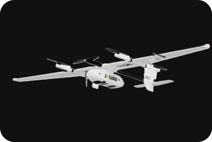
JOUAV CW-15
The JOUAV CW-15 is a highly capable VTOL (Vertical Take-Off and Landing) fixed-wing drone designed for long-range missions, surveying, mapping, and industrial inspection. Known for its ruggedness, versatility, and endurance, the CW-15 is used across various industries such as aerial mapping, agriculture, infrastructure inspection, emergency response, and more. With its hybrid VTOL capability, it combines the advantages of multi-rotor and fixed-wing drones, offering vertical take-off and long-endurance flight.
Technical Specifications
1. Key Specifications:
- Drone Type: Fixed-wing with VTOL capability (Hybrid).
- Max Flight Time: Up to 180 minutes.
- Max Range: Over 100 km (62 miles).
- Max Takeoff Weight: 14.5 kg.
- Payload Capacity: Up to 3 kg.
- Cruising Speed: 61 km/h (17 m/s).
- Max Speed: 90 km/h (25 m/s).
- Endurance: Up to 3 hours of continuous flight.
- GNSS System: RTK/PPK supported for high-precision mapping applications.
- Operating Temperature: -20°C to 45°C (-4°F to 113°F).
- Wind Resistance: Can withstand wind speeds up to 40 km/h.
2. Design and VTOL Capabilities:
The JOUAV CW-15 is a hybrid VTOL fixed-wing drone, meaning it combines vertical take-off and landing capabilities (like a quadcopter) with the long-endurance flight characteristics of a fixed-wing aircraft.
- VTOL System: Equipped with four electric rotors for vertical takeoff and landing, allowing the drone to operate in confined spaces without the need for runways.
- Fixed-Wing Configuration: Once airborne, the drone switches to a fixed-wing mode, enabling efficient and long-range flight, conserving energy compared to multi-rotor drones.
- Modular Design: The CW-15 features a modular design that simplifies assembly, disassembly, and transportation, making it ideal for field operations.
3. Payload Options:
The CW-15 is designed to carry a wide range of payloads for different missions. Its 3 kg payload capacity allows it to accommodate advanced sensors and cameras, making it versatile for professional use in various industries.
-
Aerial Cameras for Photogrammetry and Mapping:
-
-
- RGB Cameras: High-resolution RGB cameras are used for aerial photography and Orth mosaic mapping.
- Multispectral Cameras: Equipped with multispectral sensors for agricultural monitoring, crop health analysis, and precision farming.
- LiDAR Sensors: Can carry LiDAR sensors to capture 3D point clouds for terrain mapping, topographical analysis, and infrastructure inspection.
- Thermal Imaging Cameras: Available for use in search and rescue missions, firefighting, and industrial inspections that require thermal imaging.
-
-
Interchangeable Payloads:
-
-
- The drone supports interchangeable payloads, allowing users to easily switch between different types of sensors or cameras depending on the mission requirements. This makes the CW-15 adaptable to various industries and use cases.
-
4. Flight Performance:
- Max Endurance: The CW-15 can fly for up to 3 hours, making it suitable for long-range surveying and mapping missions over large areas.
- Cruise Speed: It has a cruising speed of 61 km/h, allowing for efficient data collection over extended areas, such as large construction sites, agricultural fields, or rural environments.
- Range: The CW-15 is capable of flying beyond 100 km in a single mission, making it ideal for long-range operations such as pipeline inspections or large-scale mapping projects.
- VTOL Flexibility: The ability to take off and land vertically gives the CW-15 a significant advantage in areas where traditional runways are unavailable, such as mountainous regions or dense urban environments.
5. RTK/PPK Accuracy for Mapping:
The CW-15 is designed for high-precision aerial mapping. It integrates RTK (Real-Time Kinematic) and PPK (Post-Processed Kinematic) positioning systems, ensuring centimeter-level accuracy for geospatial data collection.
- RTK Integration: Provides real-time corrections to GNSS signals, offering centimeter-level positional accuracy during flight. This makes the CW-15 ideal for use in surveying, topographic mapping, and infrastructure inspection where accuracy is critical.
- PPK Support: When RTK corrections are unavailable, PPK can be used to refine positional data during post-flight processing, ensuring the highest possible accuracy in mapping outputs.
6. Applications:
The JOUAV CW-15 is versatile and can be used in a wide variety of professional industries:
-
Surveying and Mapping:
-
- Topographic Mapping: With its high-precision RTK/PPK capabilities and long endurance, the CW-15 is perfect for large-area topographical surveys.
- 3D Modeling: Can create accurate 3D models and point clouds using aerial imagery and LiDAR sensors.
- Orth mosaics: Capable of capturing detailed Orth mosaic maps with centimeter-level accuracy, making it suitable for projects requiring highly accurate geospatial data.
-
Agriculture:
-
- Crop Health Monitoring: The drone can be fitted with multispectral cameras for vegetation analysis, detecting crop health, and assessing NDVI (Normalized Difference Vegetation Index).
- Precision Agriculture: It supports precision agriculture applications like irrigation planning, yield estimation, and pest monitoring.
-
Infrastructure Inspection:
-
- Energy Sector: The CW-15 is widely used for the inspection of power lines, wind turbines, and solar farms. Its thermal sensors detect anomalies such as overheating or electrical faults.
- Pipeline Inspection: The drone can perform long-range inspections of pipelines, railways, or roads, capturing detailed data on infrastructure conditions.
-
Public Safety & Emergency Response:
-
- Search and Rescue: With its thermal imaging capabilities, the CW-15 can assist in locating missing persons, especially in hard-to-reach areas.
- Disaster Management: The drone can quickly survey disaster-stricken areas to assess damage and plan response strategies, particularly in regions affected by floods, earthquakes, or fires.
7. Software and Ground Control:
The CW-15 is compatible with JOUAV’s Ground Control Station (GCS), offering real-time flight control, mission planning, and data collection. The GCS system provides a user-friendly interface for pilots and operators.
- Mission Planning: The software allows operators to create waypoint-based missions, adjust flight parameters such as altitude and speed, and monitor the drone’s status during the mission.
- Live Data Transmission: Provides live data transmission and telemetry, allowing for real-time monitoring of the mission’s progress and data collection.
- Data Processing: The drone’s captured data can be processed using third-party software platforms such as Pix4D or DroneDeploy for photogrammetry, 3D modeling, and map creation.
8. Safety Features:
The JOUAV CW-15 comes equipped with several advanced safety and redundancy systems to ensure safe and reliable operations:
- Multiple Redundancies: The drone is equipped with dual GNSS systems, dual flight controllers, and fail-safe systems to maintain stable flight even in the event of technical failures.
- Obstacle Avoidance: Advanced obstacle detection and avoidance systems ensure safe navigation, particularly during low-altitude missions or in complex environments.
- Automatic Return-to-Home: In the case of lost communication, low battery, or other emergencies, the CW-15 is programmed to automatically return to its home location, ensuring the safety of both the drone and the mission.
9. Battery and Charging:
- Battery Type: The CW-15 uses high-capacity lithium-polymer (LiPo) batteries, providing long flight times.
- Charging System: The drone’s batteries are swappable, allowing for quick battery replacement between missions. Battery management systems ensure safe charging and optimal performance.