
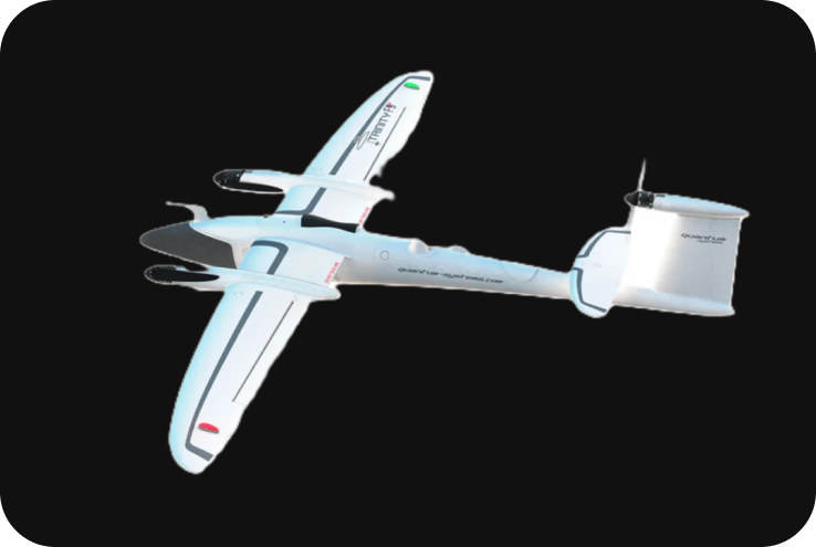
Quantum Trinity F90+
The Quantum Systems Trinity F90+ is a professional VTOL (Vertical Take-Off and Landing) fixed-wing drone designed for long-range, high-accuracy mapping, surveying, and data collection missions. Known for its endurance, versatility, and ability to carry a variety of payloads, the Trinity F90+ is widely used in industries such as agriculture, mining, forestry, environmental monitoring, and infrastructure inspection.
Technical Specifications
1. Key Specifications:
- Drone Type: VTOL fixed-wing drone.
- Max Flight Time: Up to 90 minutes.
- Max Range: 100 km (62 miles) in one flight.
- Max Coverage: Up to 700 hectares (1,730 acres) at 120m altitude.
- Wingspan: 2.4 meters (7.87 feet).
- Max Takeoff Weight: 5 kg (11 lbs).
- Max Payload Weight: 700 g (1.54 lbs).
- Cruise Speed: 17 m/s (38 mph).
- Wind Resistance: Up to 12 m/s (27 mph).
- Operating Temperature: -12°C to 50°C (10°F to 122°F).
- Max Flight Altitude: Up to 5000 m (16,404 ft) above sea level.
- Battery Type: 14.8V Lithium-ion (hot-swappable).
- GNSS: GPS + GLONASS + Galileo.
- RTK/PPK: Optional Real-Time Kinematic (RTK) and Post-Processed Kinematic (PPK) support for centimeter-level accuracy.
2. VTOL Capabilities:
The Trinity F90+ is a VTOL drone, offering the best of both worlds—multirotor-style vertical takeoff and landing with fixed-wing efficiency during flight.
- Vertical Take-Off and Landing (VTOL): The drone takes off and lands vertically, eliminating the need for a runway or large open spaces. This makes it ideal for confined areas or rough terrain.
- Fixed-Wing Flight: After take-off, the Trinity F90+ transitions into efficient fixed-wing flight, providing greater range and endurance for long-duration mapping missions.
3. Payload and Camera Options:
The Trinity F90+ supports a variety of payloads, including high-resolution RGB cameras, multispectral sensors, and LiDAR systems. This flexibility makes it ideal for different types of aerial surveys and data collection missions.
- Sony UMC-R10C: 20.1 MP RGB camera for high-resolution photogrammetry.
- Micasense RedEdge-MX: A multispectral camera that captures five spectral bands (blue, green, red, red edge, and near-infrared) for agricultural applications like crop health monitoring and precision farming.
- Sony RX1R II: 42 MP full-frame camera capable of capturing images with a GSD (Ground Sampling Distance) as low as 1 cm/px for high-precision mapping.
- Qube 240 LiDAR: LiDAR system with 240,000 points per second, suitable for generating detailed 3D point clouds and mapping complex terrain.
- Thermal Sensors: Optional payload for thermal imaging applications, such as search and rescue, infrastructure inspection, and environmental monitoring.
4. RTK and PPK for High Precision:
The Trinity F90+ supports both RTK (Real-Time Kinematic) and PPK (Post-Processed Kinematic) positioning technologies, providing centimeter-level accuracy without the need for Ground Control Points (GCPs).
- RTK (Real-Time Kinematic): Provides real-time correction data during flight for highly accurate georeferencing of aerial data.
- PPK (Post-Processed Kinematic): Allows for post-flight correction of GNSS data, ensuring high accuracy even in areas with poor satellite reception or challenging conditions.
- Centimeter-Level Accuracy: With RTK/PPK, the Trinity F90+ can achieve up to 2 cm horizontal and 3 cm vertical accuracy, making it ideal for precision surveying and mapping.
5. Flight Time and Coverage:
The Trinity F90+ is designed for long-duration flights and can cover vast areas in a single mission, making it highly efficient for large-scale mapping and surveying projects.
- Flight Time: Up to 90 minutes per flight, depending on the payload and flight conditions.
- Max Coverage: Can cover up to 700 hectares (1,730 acres) in a single flight at 120 meters altitude with a GSD of 3 cm/px.
- Terrain Following: The Trinity F90+ can be equipped with a terrain-following mode, which automatically adjusts flight altitude to maintain consistent ground sampling distance over uneven terrain.
6. Mission Planning and Software:
The Trinity F90+ is compatible with QBase 3D software, which provides powerful mission planning, flight control, and data management features.
- QBase 3D Software: An intuitive mission planning and control software that allows operators to plan flights, set waypoints, and define flight parameters like altitude and speed.
- Automated Missions: Fully autonomous missions from take-off to landing. The software calculates the optimal flight route and ensures complete coverage of the target area.
- Data Management: QBase 3D also manages post-flight data, allowing for easy integration with third-party processing software like Pix4D, Agisoft Metashape, or DJI Terra for generating orthophotos, 3D models, and digital terrain models (DTMs).
7. Advanced GNSS and Sensors:
The Trinity F90+ is equipped with advanced GNSS and sensors that enhance its navigation and data collection capabilities.
- GNSS Support: The drone supports GPS, GLONASS, and Galileo satellite systems for robust positioning.
- Redundant Sensors: Redundant IMU and GNSS sensors ensure reliable flight performance and safety, even in challenging environments.
- Fail-Safe Mechanisms: The Trinity F90+ includes fail-safe features such as automatic return-to-home in case of signal loss, low battery, or other emergencies.
8. Applications:
The Trinity F90+ is designed for a wide range of industrial and commercial applications, including:
- Land Surveying: Captures highly accurate, georeferenced imagery for producing orthomosaic maps, topographic maps, and digital elevation models (DEMs).
- Agriculture: Multispectral payloads provide valuable data for crop health monitoring, yield optimization, and precision farming practices.
- Forestry: High-resolution imagery and LiDAR payloads allow for forest inventory, canopy analysis, and environmental monitoring.
- Mining and Aggregates: Conduct volumetric analysis, measure stockpiles, and track changes over time in open-pit mines and quarries.
- Infrastructure Inspection: Use high-resolution cameras or thermal sensors to inspect large infrastructure projects such as roads, bridges, pipelines, and power lines.
- Environmental Monitoring: Ideal for tracking changes in natural landscapes, coastlines, and forests for environmental studies and conservation projects.
- Search and Rescue: With the option of thermal payloads, the Trinity F90+ can be used for search and rescue operations, providing real-time data on large areas in challenging environments.
9. Integration and Data Processing:
The Trinity F90+ is compatible with various data processing platforms for creating high-quality outputs:
- Photogrammetry Software: Fully compatible with industry-standard software like Pix4D, Agisoft Metashape, and Trimble Business Center for generating Orth mosaics, 3D models, and point clouds.
- LiDAR Data Processing: For LiDAR data, the drone’s output can be processed in software like TerraSolid or Global Mapper to generate highly detailed 3D maps and terrain models.
- Multispectral Analysis: Data from multispectral cameras can be processed using software like Pix4Dfields or Agisoft Metashape Pro for vegetation analysis and precision agriculture applications.
10. Safety Features:
The Trinity F90+ is equipped with multiple safety and redundancy features to ensure safe and reliable operation:
- VTOL: Vertical take-off and landing reduce the risk of crash landings and allow the drone to operate in confined areas.
- Automatic Return to Home: In case of low battery, signal loss, or other emergencies, the drone automatically returns to its takeoff point.
- Redundant GNSS and IMU Sensors: These systems ensure reliable positioning and navigation during flight, even in areas with weak satellite reception.
- Failsafe Mechanisms: Built-in safety features ensure that the drone can recover from unexpected issues such as power loss or environmental challenges.
11. Battery and Charging:
-
- Battery Type: 14.8V Lithium-ion battery (hot-swappable), designed for long-endurance flights.
- Flight Time: The battery provides up to 90 minutes of flight time, allowing for extensive data collection during a single mission.
- Charging Hub: The Trinity F90+ includes a battery charging system that can quickly charge multiple batteries, reducing downtime between flights.