
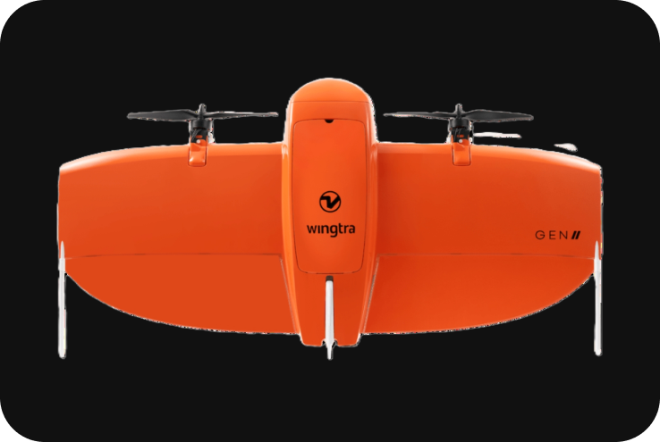
WingtraOne
The WingtraOne is a professional VTOL (Vertical Take-Off and Landing) drone designed specifically for large-scale mapping, surveying, and 3D modeling. It is known for its exceptional flight time, payload capacity, and high-precision data collection, making it a popular choice for industries like construction, mining, environmental monitoring, and agriculture. Below are the full details of the Wingtra drone.
Technical Specifications
1. Key Specifications:
- Drone Type: VTOL (Vertical Take-Off and Landing) fixed-wing drone.
- Max Flight Time: Up to 59 minutes.
- Max Coverage: Up to 1100 hectares (2700 acres) at 3 cm/px GSD (Ground Sampling Distance) in one flight.
- Max Take-Off Weight: 3.7 kg (8.16 lbs).
- Max Payload Weight: 800 g (1.76 lbs.).
- Wind Resistance: Up to 45 km/h (28 mph).
- Operating Temperature: -10°C to 40°C (14°F to 104°F).
- Max Flight Altitude: Up to 5,000 m (16,404 ft) above sea level.
- Landing Area Requirement: Minimal flat space due to VTOL ability.
- GNSS: GPS + GLONASS + Galileo.
- RTK/PPK: Supports Real-Time Kinematic (RTK) and Post-Processed Kinematic (PPK) for centimeter-level accuracy.
2. VTOL (Vertical Take-Off and Landing) Capabilities:
The WingtraOne is a VTOL drone, meaning it takes off and lands like a multirotor but transitions to fixed-wing flight for more efficient data collection over large areas. This design combines the flexibility of multirotor drones with the endurance and range of fixed-wing UAVs.
- Vertical Take-Off and Landing: No need for runways or catapults, making it ideal for confined areas or uneven terrain.
- Fixed-Wing Efficiency: After take-off, the WingtraOne transitions into a fixed-wing mode for longer flights, allowing it to cover large areas efficiently.
3. Payload Options:
The WingtraOne is designed to be a versatile mapping platform, supporting several high-quality cameras and sensors for different applications.
- Sony RX1R II (42MP): The most popular payload for high-accuracy mapping and photogrammetry, capable of achieving GSD (Ground Sampling Distance) as low as 0.7 cm/px. Ideal for projects requiring very high-resolution imagery.
- Sony a6100 (24MP): Provides high-quality imagery for general mapping applications.
- MicaSense RedEdge-MX: A multispectral camera designed for agricultural mapping, crop health monitoring, and precision farming. Collects data across five spectral bands for detailed vegetation analysis.
- Oblique Camera Systems: For advanced 3D mapping and city modeling, WingtraOne can carry payloads that capture oblique images at multiple angles, providing data for complex terrain models and building facades.
- Quantum Systems’ LiDAR Payload (COMING SOON): The drone is expected to support LiDAR payloads for creating highly detailed 3D models of terrain and vegetation in near future models.
4. RTK/PPK for High Accuracy:
The WingtraOne comes with RTK/PPK technology for centimeter-level positioning accuracy, minimizing the need for Ground Control Points (GCPs).
- Real-Time Kinematic (RTK): Provides real-time corrections during flight, ensuring high positional accuracy during data capture.
- Post-Processed Kinematic (PPK): Allows for post-flight data correction, enhancing accuracy even further and ensuring reliable results in areas with poor satellite reception.
- Accuracy: Achieves down to 1 cm horizontal and 3 cm vertical accuracy, depending on the payload and conditions.
5. Flight Time and Coverage:
The WingtraOne is optimized for long-endurance flights and can cover vast areas in a single mission.
- Flight Time: Up to 59 minutes per flight, depending on the payload and flight conditions.
- Max Coverage: Up to 1100 hectares (2700 acres) in a single flight at 3 cm/px GSD, making it one of the most efficient drones for large-scale mapping projects.
- Terrain Following: The drone features a terrain-following mode, which automatically adjusts altitude to ensure consistent GSD across uneven terrain.
6. Mission Planning and Software:
The WingtraOne is compatible with the WingtraPilot software, which offers intuitive mission planning and control, allowing operators to efficiently execute complex surveying and mapping missions.
- Wingtra Pilot Software: The flight planning software is easy to use, enabling users to define waypoints, set the desired altitude, and define the coverage area. The software optimizes flight routes for maximum efficiency.
- Terrain Following: Automatically adjusts flight altitude to follow terrain, ensuring consistent data collection over uneven landscapes.
- Fail-Safe Features: Includes features like automatic return-to-home and mission resume after unexpected interruptions (e.g., low battery or lost signal).
7. Camera and Imaging Capabilities:
The drone’s camera payloads are designed to capture high-resolution, georeferenced images for use in orthophotos, point clouds, and 3D models.
- Sony RX1R II (42MP): Produces ultra-high-resolution images (up to 0.7 cm/px GSD) with exceptional clarity, making it ideal for land surveying, construction monitoring, and mining applications.
- Sony a6100 (24MP): A versatile camera for general mapping, capable of delivering 1.2 cm/px GSD.
- MicaSense RedEdge-MX: Multispectral camera for agricultural analysis and vegetation monitoring, capable of capturing data in five spectral bands.
8. Applications:
- Land Surveying: Captures highly accurate, georeferenced imagery for producing topographic maps, orthophotos, and 3D terrain models.
- Mining and Aggregates: Measures stockpile volumes, maps large mining sites, and tracks changes over time.
- Construction: Tracks site progress, monitors earthworks, and produces as-built documentation.
- Agriculture: The multispectral payload can be used for crop health analysis, precision farming, and yield optimization.
- Environmental Monitoring: Maps changes in landscapes, forests, and coastal areas for environmental studies.
- Infrastructure Inspection: Maps large infrastructure projects such as railways, roads, pipelines, and power lines.
9. Data Processing and Integration:
The WingtraOne is compatible with a wide variety of data processing software to generate high-quality maps, 3D models, and analysis outputs.
- WingtraPilot Data: Captured images can be processed in industry-standard photogrammetry software like Pix4D, Agisoft Metashape, or DroneDeploy.
- Post-Flight Processing: The PPK workflow allows for centimeter-level data accuracy by correcting GNSS data after the flight.
10. Safety Features:
The WingtraOne is equipped with multiple safety features to ensure secure and reliable operation, even in complex environments:
- VTOL Take-Off and Landing: Reduces the risk of crash landings and allows the drone to operate in confined areas.
- Return-to-Home: Automatically returns to its take-off point if it loses signal or experiences low battery.
- Failsafe Features: Includes redundancy in its positioning system and battery, ensuring safe recovery during unexpected failures.
- Wind Resistance: Can handle winds up to 45 km/h, ensuring stable flight and data collection in various conditions.
11. Battery and Charging:
- Battery: 99.9Wh Lithium-ion, hot-swappable.
- Flight Time: Up to 59 minutes of flight time per battery, allowing extensive data collection in one mission.
Charging: The WingtraOne includes an efficient charging system, with the ability to swap batteries quickly between missions for minimal downtime.